Elevation & 3D mapping

DSM and DTM contours, and 3D maps

DSM and DTM contour mapping, and 3D map generation. Contours and the 3D map sit with the orthophoto as the elevation record from the survey.

DSM and DTM contours are the elevation products used for terrain review and for volume work on a stockpile or a pit.

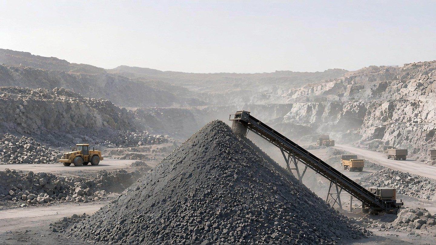
Aerial view of a quarry and stockpiles.

What it helps you understand

The height and shape of the ground

DSM and DTM contour mapping and 3D map generation.

Workflow

Capture, processing, QA, delivery

  1. CaptureDGPS and aerial mapping
  2. ProcessingDSM, DTM and 3D maps
  3. QAImage and data checks
  4. DeliveryContours and the report

The outcome is the elevation record: DSM and DTM contours and a 3D map, with the report in cloud storage.

  1. Capture

    Ground and aerial surveying for this mapping uses DGPS surveys and drone-based aerial mapping. Drone capture is one survey method.

  2. Processing

    DSM and DTM contour mapping, and 3D map generation.

  3. QA

    Image quality verification during collection. The visualisation software includes data-validation workflows.

  4. Delivery

    DSM and DTM contours and 3D maps, with report generation and cloud storage.

Deliverables

  • DSM contours
  • DTM contours
  • 3D maps

Inputs and outputs

Inputs

DGPS surveys and imagery from drone-based aerial mapping.

Outputs

DSM and DTM contours, and 3D maps.

Elevation and contours

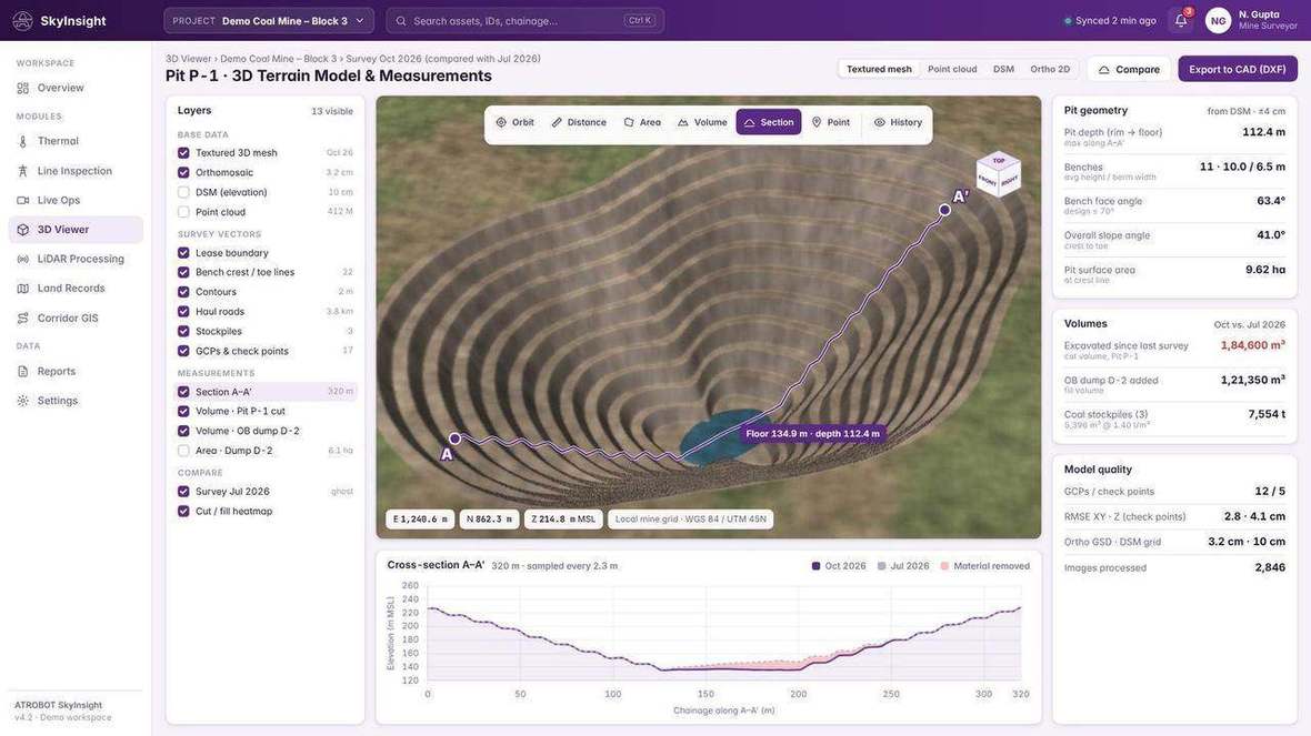
  • Visualisation workspace showing a 3D terrain view.
    3D terrain view in the visualisation workspace.
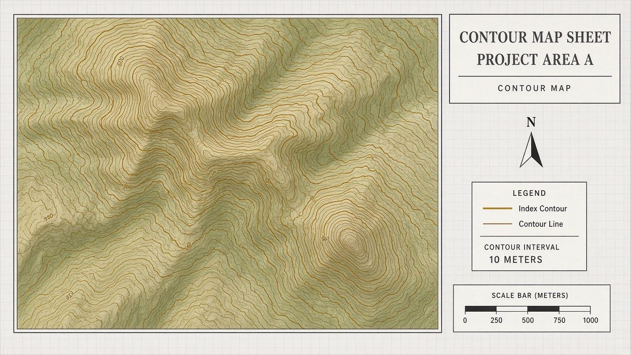
  • Illustrated contour map over a valley.
    Illustrated contour map over a valley.

Industries

Software

How this connects to the software

Big Data Management

A cloud system for operational, GIS and infrastructure data, including data collected by drone survey.

FAQ

Frequently asked questions

DSM and DTM contours, and 3D maps.

DGPS surveys and drone-based aerial mapping. Drone capture is one survey method.

Request a Consultation. The enquiry goes to business@atrobot.in. You can also call +91-9319044881.

Spatial & AI Workflow Architecture

End-to-end multi-modal data pipeline

Every survey, LiDAR point cloud and inspection dataset flows through Atrobot’s georeferenced processing and validation architecture into cloud GIS.

Multi-Sensor Ingestion
Aerial RGB & Photogrammetry High-overlap RTK/PPK nadiral and oblique imagery for centimetre-grade orthomosaics and 3D reality meshes.
Airborne LiDAR & Point Clouds Multi-return LAS/LAZ point clouds penetrating vegetation for bare-earth DTM, DSM and structural clearance.
Radiometric Thermal & DGPS Control Calibrated thermal arrays paired with DGPS base-rover GCP networks and subsurface GPR profiles.
Atrobot Spatial AI Core
01 · Photogrammetric & LiDAR Fusion GEOREFERENCED Automated bundle adjustment, trajectory alignment, strip registration and radiometric calibration.
02 · Computer Vision & Defect AI AUTOMATED Thermal hotspot classification, volumetric cut/fill meshes, haul-road grade checks and encroachment detection.
03 · Temporal Digital Twin Engine TIME-SERIES Multi-epoch change detection, progress tracking against CAD/BIM design surfaces and audit-ready logs.
Cloud GIS & Enterprise Outputs
Interactive 2D / 3D Web Workspace Browser-native streaming of orthophotos, point clouds, cross-sections and volumetric measurements.
CAD, BIM & GIS Deliverables Ready-to-use GeoTIFF, LAS/LAZ, SHP, GeoJSON, DXF contours and DPR engineering packages.
Automated Alerts & O&M Reports Geotagged fault registers, stockpile tonnage summaries and ERP/IoT API synchronization.

Next step

Request a Consultation

The enquiry goes to business@atrobot.in. You can also call +91-9319044881.

Chat on WhatsApp